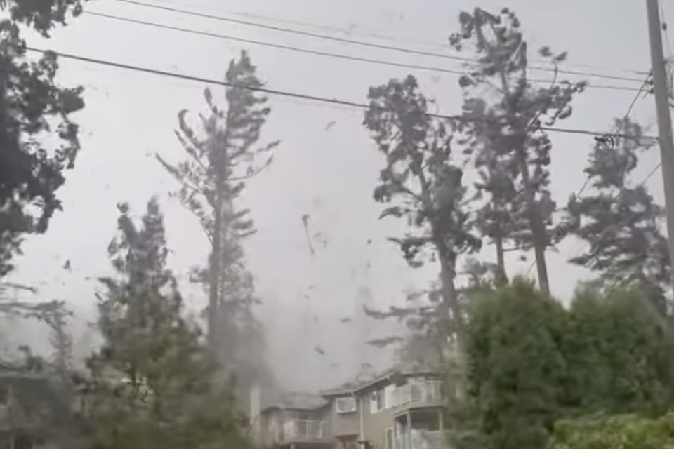
A low-grade tornado touched down on the Sunshine Coast Monday (Nov. 4) during the windstorm that ripped through the south coast.
Environment Canada meteorologist Ken Dosanjh told Black Press Media Thursday that an EF0 tornado – the lowest tornado classification – was recorded on the Sunshine Coast.
Tornadoes are classified on the six-point Enhanced Fujita (EF) scale, with zero being the weakest and five being the strongest, he said.
"There were of the tornado around the west of Sechelt that did cause tree damage," Dosanjh said. "Thankfully, no injuries were reported, but we do have a preliminary assessment of an EF0 tornado with radar estimation showing (maximum) winds of 115 kilometres per hour."
He added it travelled just under a kilometre.
, which mostly swept through the south coast on Monday, left nearly 300,000 homes and businesses without power at the peak after wind gusts of more than 100 km/h in several areas.
Dosanjh said the windstorm started out primarily with strong winds from the south and southeast, but it was near Sechelt, along the Sunshine Coast, that meteorologists "noticed the transition from the southeast winds to the northwest, so the winds for the south coast did a bit of a switch."
B.C. does get that form along the Salish Sea, but Dosanjh said that in terms of tornadoes occurring over land "it's fairly rare." Waterspouts are described as a whirling column of air and water mist.
"British Columbia, as a whole, we don't typically see too many tornadoes when you compare it to our counterparts, like the Prairies, where theirs is more thermodynamically based. What I mean by that is during the summer you get a lot of seeding of the soil and pretty much it can create these evapotranspiration, which basically creates these super strong cells."
However, Dosanjh said that while tornadoes aren't too common in B.C., nearly three years ago to the day, on Nov. 6, 2021, there was one reported over Vancouver. Another was in Victoria in the spring of 2020.


